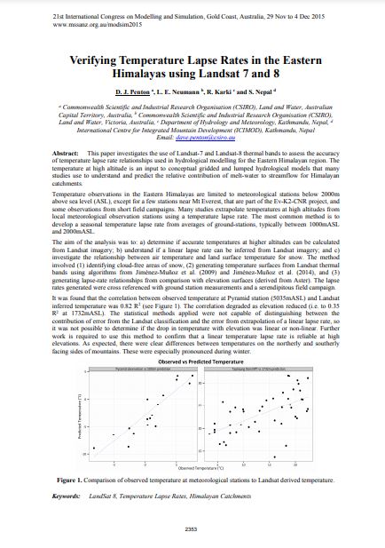
This paper investigates the use of Landsat-7 and Landsat-8 thermal bands to assess the accuracy of temperature lapse rate relationships used in hydrological modelling for the Eastern Himalayan region. The temperature at high altitude is an input to conceptual gridded and lumped hydrological models that many studies use to understand and predict the relative contribution of melt-water to streamflow for Himalayan catchments.